The Animated Wind Forecast Map

Earth.nullschool.net's gorgeous animated globe, visualizing weather conditions around the world, has become the inspiration for many maps. For example Esri took the same weather data from the Global Forecast System used in the earth.nullschool.net map and created Windy-JS.

Windy-JS re-purposes the weather data so that it can be overlaid in a canvas element on top of a variety of mapping APIs. Esri has even created a demo map with Windy-JS, Wind Animation, which allows you to view global wind conditions animated on a slippy map.
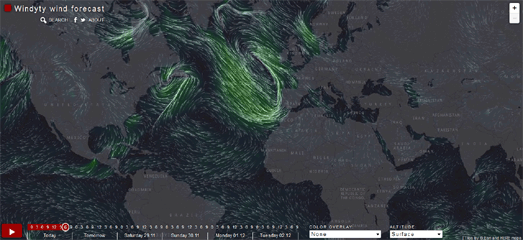
Now Windyty has taken the same approach to create an animated wind forecast map based on NOAA wind data. The Windyty Wind Forecast map is very similar to the Windy-JS map. Like Windy-JS the Windyty map beautifully animates wind patterns on top of a global map.
However Windyty also allows you to view forecast wind patterns for the next five day. The map includes a number of other weather layers (including cloud cover and temperature) and allows you to view animated wind patterns at a number of different altitudes.


Comments